Maps by Year of Bias Motivated Incident
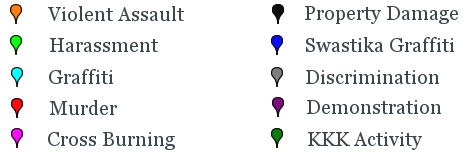
The interactive map of bias-motivated incidents below sorts incidents by year. The markers are color coded by type; a key is provided below the map. Checking the boxes to the right of the map will turn that specific year on or off. All are "on" by default. Use the scale on the left to enlarge the map. Click on any incident to get a brief description. For most incidents originally reported in the Northwest Indiana Times and for some reported in the Post-Tribune, a link to the original newspaper report is provided.
Markers on the map are intended to indicate only approximate positions of incidents. Incidents are mapped based on the most accurate information available; however, published reports of incidents do not always provide information that allows precise mapping. Many markers are placed based on street names and block numbers rather than exact addresses, and a few are mapped based only on the city in which the incident occured. For more details about each incident, please click through to the original published reports.